Exploring Tenerife begins with a map — and if you’re searching for maps Tenerife Spain to plan your visit, you’ve come to the right place. Whether you’re planning a road trip through the winding mountain passes of Anaga, searching for a hidden black-sand beach, or simply trying to understand where Tenerife sits in relation to mainland Spain, the right map makes all the difference.
In this comprehensive guide to maps Tenerife Spain, we bring together every possible type of map you might need — from interactive Google Maps to downloadable PDF brochures, from modern digital tools to vintage historical scans rarely seen by the average traveler.
While many travelers search for a simple Tenerife Spain map online, few realize the variety available: tourist maps, road maps, bus network diagrams, hiking trail overlays, satellite imagery, and even offline navigation apps. Each one serves a different purpose depending on how you plan to explore the island — by foot, by car, or virtually.
But there’s more to this article than just links to downloads or screenshots. You’ll find:
- How to locate Tenerife on a map of Spain
- Where to find interactive Google Maps that show ferry terminals, national parks, and city centers
- The best PDF maps issued by local tourist boards
- Specialized hiking and road maps for Teide National Park and beyond
- Archived scans of centuries-old maps that show how Tenerife has been viewed across history
- Printable maps for tourists with beaches, resorts, and attractions clearly marked
Whether you’re a digital nomad who relies on GPS apps, a tourist who prefers a foldable map in your pocket, or a geography enthusiast seeking map of Spain showing Tenerife, this guide covers it all.
So grab your compass — or just your phone — and let’s begin navigating the island of Tenerife from every possible angle.
Where is Tenerife Located on the Map of Spain?
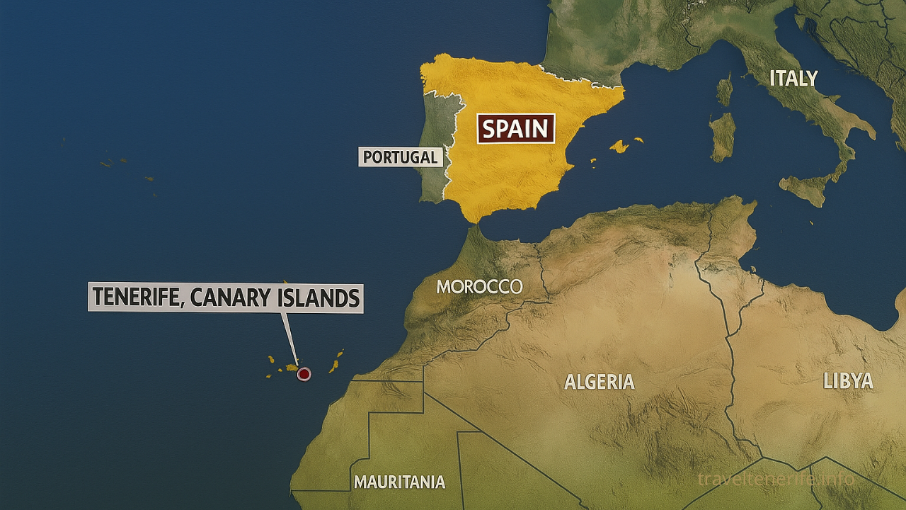
When people try to find Tenerife on map of Spain, they’re often surprised by its distance from the mainland. In fact, if you look for Tenerife on a map of Spain, you’ll find it far to the southwest, off the coast of northwestern Africa. Despite the distance, Tenerife is one of Spain’s most visited islands, and its unique location adds to its exotic appeal.
On most conventional maps of Spain, Tenerife and the other Canary Islands are displayed in a small box inserted in the lower corner. This can make it seem like they’re close to mainland Europe, but in reality, Tenerife lies about 1,300 kilometers from Madrid and around 100 kilometers west of the Moroccan coast. Its geographical coordinates are approximately 28.2916° N, 16.6291° W.
To get a proper sense of its position, we recommend viewing a map of Spain showing Tenerife in satellite mode on Google Maps. This provides real-world context of its oceanic isolation, volcanic terrain, and proximity to the African continent. For those wondering about the connection between Tenerife and Spain, maps clearly reveal that Tenerife is the largest of the seven Canary Islands and operates as an autonomous community under the Spanish flag.
Using an interactive Spain-Tenerife map, you’ll see how the island is connected via ferry and flight routes to mainland Spain and the other islands in the archipelago. On digital maps, Tenerife’s silhouette is recognizable by its triangular shape dominated by Mount Teide, the highest peak in Spain.
Whether you’re a geography enthusiast or a tourist planning your route, understanding where Tenerife is located on the map of Spain is essential. It not only helps in orientation, but also gives insight into the island’s climate, culture, and connectivity.
Locating Tenerife Spain on map helps visualize its volcanic terrain and Atlantic setting — far removed from the Iberian Peninsula, yet fully integrated into Spain’s political structure.
Interactive Google Maps of Tenerife
In today’s digital world, Google Maps is the go-to tool for navigating new destinations — and Tenerife is no exception. Whether you’re driving across the island, exploring hidden beaches, or searching for ferry terminals, Google Maps provides a reliable, real-time view of Tenerife’s unique landscape.
A quick search for “Tenerife Spain map Google” will bring up the island’s iconic triangular shape, framed by the Atlantic Ocean and dominated by Mount Teide, Spain’s tallest peak. From this satellite perspective, it’s easy to spot cities like Santa Cruz, La Laguna, and Los Cristianos, as well as rural regions like Anaga and Teide National Park.
Here are direct links to some of the most useful locations on Google Maps for anyone visiting Tenerife:
- Tenerife Island Overview
(Coordinates: 28.2916° N, 16.6291° W)
View the island’s full outline, major towns, and terrain.
- Santa Cruz de Tenerife Port
(Coordinates: 28.4636° N, 16.2477° W)
Main cruise and ferry port on the northeastern coast.
- Teide National Park
(Coordinates: 28.2724° N, 16.6425° W)
Highlighted volcanic region perfect for hiking and stargazing.
- Los Cristianos Ferry Terminal
(Coordinates: 28.0484° N, 16.7164° W)
Southern port connecting Tenerife to La Gomera, Gran Canaria, and more.
- Anaga Rural Park
(Coordinates: 28.5675° N, 16.1742° W)
Remote, mountainous terrain with dense laurel forest trails.
- Puerto de la Cruz
(Coordinates: 28.4142° N, 16.5441° W)
Charming northern city, old town, black sand beaches
- Costa Adeje
(Coordinates: 28.0862° N, 16.7335° W)
Southern resort area with shopping, beaches, and hotels
These interactive maps of Tenerife let you explore in multiple ways:
- Street View for walking through towns and seeing attractions
- Real-time traffic updates when renting a car
- Public transit info, including TITSA bus lines and stops
- Saved places to organize your personal itinerary
To prepare for offline use, Google Maps allows you to download the entire Tenerife region. This is especially useful if you plan to hike through remote areas or drive through the mountains where mobile coverage may be limited. Just zoom into the island, tap your profile photo → “Offline maps” → “Select your own map,” and choose Tenerife.
What sets Google Maps Tenerife apart from other tools is its real-time accuracy, user-generated reviews, and integrated public services. You can even find ferry departure zones, walking distances between landmarks, and parking availability — all in one app.
For modern travelers, a Tenerife Spain map on Google isn’t just a visual guide — it’s a practical, interactive assistant that helps you move with confidence around the island.
Downloadable Maps: PDF & Tourist Brochures
While digital apps are convenient for on-the-go navigation, many travelers still value the clarity and reliability of a well-designed printable map. Whether you’re offline in the mountains or simply prefer to plan with paper in hand, Tenerife offers a wide range of downloadable PDF maps that serve different purposes — from road navigation to nature exploration and urban sightseeing.
The official website of Turismo de Tenerife provides free, high-quality PDF maps tailored for visitors. These maps are printable, compatible with mobile devices, and often available in multiple languages.
These Tenerife Spain maps are ideal for offline navigation and activity planning.
Official Road Map of Tenerife
Download PDF — 8.6 MB
This detailed map covers the entire road network of Tenerife, including highways, local roads, towns, altitude levels, and key connection points. Ideal for road trippers, motorcyclists, and anyone exploring the island by car. Accurate to scale and printable in A4 format.
TITSA Bus Network Map (English)
Download PDF— 1.9 MB
An official island-wide bus map showing all TITSA routes, including airport connections, major transfer stations (e.g., Santa Cruz, Costa Adeje), and travel corridors. Perfect for navigating the public transport system efficiently.
Teide National Park Visitor Map
Download PDF— 3.8 MB
A colorful, high-resolution map showing all main trails, visitor centers, viewpoints, and geological features within Teide National Park. A must-have for hikers and anyone planning to explore Spain’s highest peak.
Beaches of Tenerife – Map and Categories
Download PDF— 5.2 MB
This booklet includes categorized beach listings (urban, natural, family-friendly, secluded) with clear map references for each coastal area. Useful for organizing beach visits based on preferences and accessibility.
Tourist Routes and Scenic Drives
Download PDF— 2.9 MB
A thematic map outlining Tenerife’s most scenic self-drive routes and hiking trails, covering areas like Masca, Anaga, and Teide. Includes route difficulty levels and landscape icons for easy planning.
Puerto de la Cruz Tourist Map
Download PDF— 1.7 MB
A compact and visual guide to the northern city of Puerto de la Cruz. Highlights key attractions, beach zones, and walking circuits. Great for city walkers and short-stay visitors.
Tenerife Cycling-Friendly Map
Download PDF — 51.4 MB
Tailored to cyclists, this map details suggested bike routes across the island, with information on elevation, road types, bike-friendly hotels, and safety notes. Recommended for both amateur and professional riders.
How to Use These Maps
All of the maps above are formatted for A4 printing but can also be stored digitally. For offline mobile use, consider saving them as PDFs in apps like Adobe Acrobat Reader, Google Drive, or Apple Books. You can also take screenshots of the relevant sections before hiking or driving.
In addition to official sources, some local travel blogs and private guides publish customized printable maps — for example, showing food tours, local markets, scenic photo spots, or lesser-known natural sites. These can be helpful complements to the official maps, especially for niche interests.
Whether you’re exploring volcanic trails, driving to remote villages, or looking for the perfect beach, having a Tenerife map in PDF format ensures you’re never without orientation — even when your signal is gone.
Road Maps and Driving Around Tenerife
Tenerife is one of the most rewarding destinations in Spain for those who love scenic drives and flexible exploration. While public transport covers the basics, renting a car gives you the freedom to access remote villages, coastal cliffs, volcanic viewpoints, and quiet mountain trails that buses don’t reach. For this, having a reliable road map of Tenerife is essential — whether printed or digital.
The island features two main highways: the TF-1, which runs along the southern and eastern coasts from Santa Cruz to Santiago del Teide, and the TF-5, which links Santa Cruz with the northwestern towns, including Puerto de la Cruz and Icod de los Vinos. Between and beyond these highways, you’ll find numerous smaller roads — some winding through steep terrain, others cutting through pine forests or lava plains. Many of these secondary routes are beautiful but narrow, so good map orientation is vital.
The Official Road Map of Tenerife (available as a downloadable PDF) is a highly recommended resource. It marks not only highways and towns but also elevation changes, viewpoints, and rural connections. It’s especially useful for planning trips to areas like Masca, Vilaflor, or El Portillo in the Teide region, where GPS coverage may be weak.
For digital convenience, Google Maps and offline apps like MAPS.ME, Sygic, or Organic Maps can also be used effectively — especially if downloaded in advance. These apps often display up-to-date road closures, gas stations, and alternative routes.
When driving around Tenerife, here are some areas where good road maps are indispensable:
- Anaga Rural Park: Extremely narrow mountain roads, often with no signal. Printed maps or offline apps help plan safe routes.
- Teide National Park: Multiple access routes with high altitudes. Elevation-aware maps show the best scenic points and rest stops.
- Masca Valley: A dramatic and winding descent with sharp curves and limited parking. Knowing the route beforehand avoids surprises.
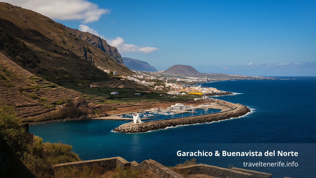
- Northwestern coast (Buenavista to Garachico): A mix of coastal and cliffside roads. Some are rarely marked on simplified navigation apps.
Parking is relatively easy outside of urban centers, but in Santa Cruz, La Laguna, and Puerto de la Cruz, drivers should use municipal parking lots or pay attention to street signage, as restrictions apply.
Fuel stations are widely available along the main highways, but fewer in the central and rural zones. The road map PDF marks the locations of the major ones, which can help when planning longer cross-island drives.
Whether you’re exploring at leisure or navigating between accommodations, reliable Tenerife road maps — both printed and digital — will enhance your experience, reduce stress, and reveal parts of the island you may otherwise miss.
Hiking and Nature Trail Maps in Tenerife
Tenerife offers some of the most diverse and scenic hiking in Spain, from coastal walks and forest trails to volcanic ascents through surreal lava fields. Whether you’re a casual walker or a seasoned trekker, having the right Tenerife map (download PDF) is crucial for safe and rewarding exploration — especially in protected areas like Anaga, Teide, and Teno.
The island has hundreds of kilometers of marked trails, many of which pass through rugged, remote terrain where GPS signals can be unreliable. That’s why reliable hiking maps — both printed and digital — are highly recommended. These maps help you identify trail entrances, distance markers, elevation profiles, difficulty ratings, and connection points to bus stops or parking areas.
One of the most valuable resources is the official hiking map of Tenerife, available as a free downloadable PDF from Turismo de Tenerife. This document includes the entire network of trails, including well-known routes like:
- Masca Gorge Trail (Barranco de Masca): A dramatic downhill hike through a volcanic ravine ending at the ocean.
- Anaga Rural Park Trails: Shaded laurel forest paths that start near Cruz del Carmen and descend to coastal villages like Taganana.
- Teide National Park Circuits: Volcanic hikes with views over calderas, lava flows, and Mount Teide itself — Spain’s highest peak.
- Monte de Agua in Los Silos: One of the greenest areas in northwestern Tenerife with well-preserved forest routes.
The Anaga and Masca regions in particular benefit from topographic maps, as the paths here often branch unpredictably or include steep terrain with switchbacks. Trail signage has improved in recent years, but local maps still offer the best detail, especially in more isolated areas.
Offline apps like AllTrails, Wikiloc, and Komoot are popular among hikers in Tenerife. These platforms include GPS tracks, user reviews, and downloadable GPX files. However, they are best used in combination with PDF trail maps, which give a broader view of protected areas, access restrictions, and emergency shelters.
Be aware that some trails require advance booking, particularly within Teide National Park, and others may be seasonally closed for maintenance or safety reasons. A printed map (or its digital equivalent) can help confirm which routes are open and how they connect with transport options or parking facilities.
Old and Vintage Maps of Tenerife
For travelers and historians alike, vintage maps offer a unique way to explore the past. While modern digital maps focus on efficiency and utility, old maps of Tenerife reveal how the island was once perceived, divided, and navigated — often with stunning hand-drawn detail and artistic embellishment. These maps provide cultural and geographic context, and they are increasingly appreciated by researchers, collectors, and those curious about the island’s colonial and maritime history.
The earliest known cartographic representations of Tenerife date back to the 15th and 16th centuries, when European explorers and naval powers began mapping the Canary Islands for trade and conquest. These early maps often positioned Tenerife as a central point in Atlantic navigation routes between Europe, Africa, and the Americas.
Some early cartographic collections include both a Tenerife and Spain map, showing how the island fit into colonial strategy. These maps, often hand-drawn and richly illustrated, provide insight into historical trade routes and strategic naval positioning. Whether used for research or as decorative prints, they help contextualize Tenerife within the broader narrative of Spanish maritime expansion.
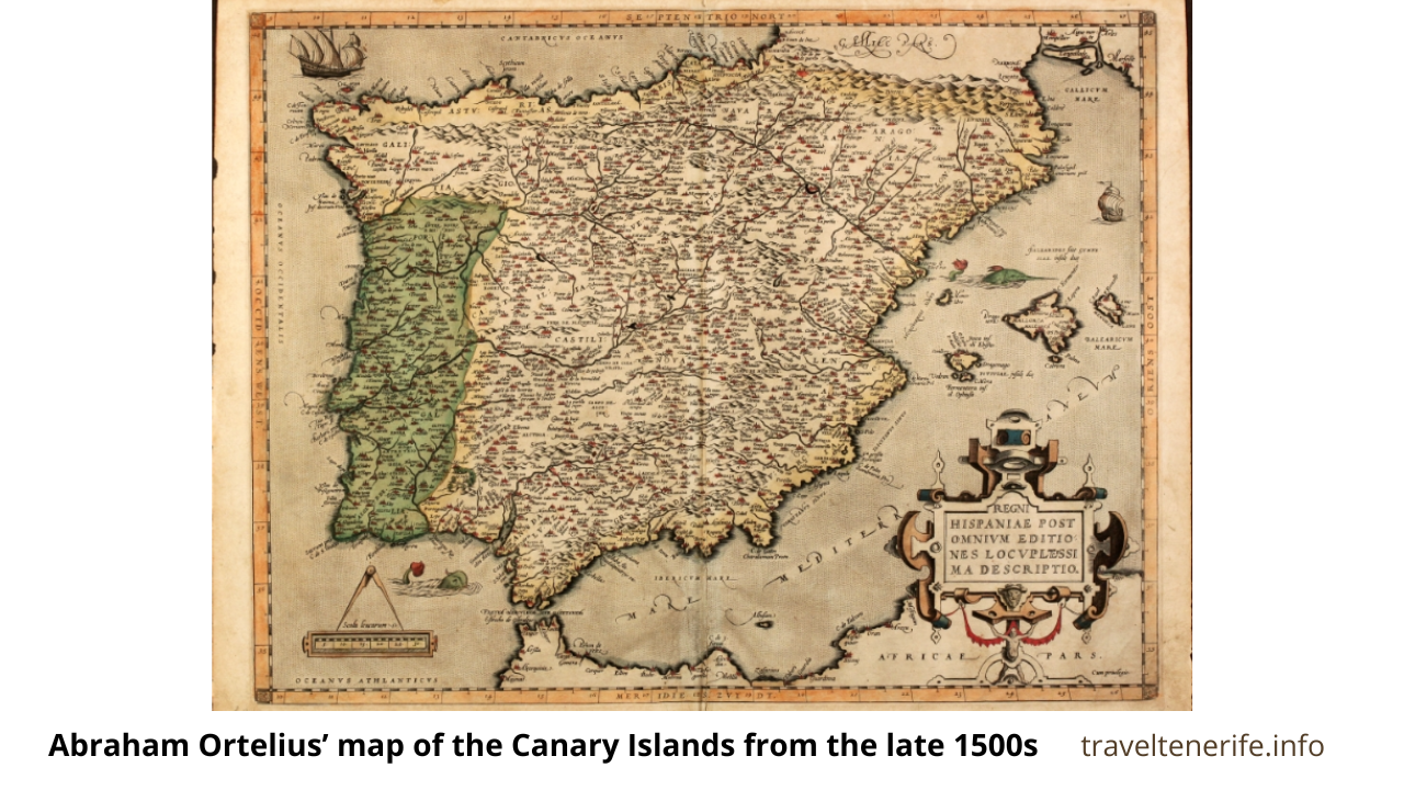
A notable example is Abraham Ortelius’ map of the Canary Islands from the late 1500s, where Tenerife is depicted alongside neighboring islands like La Palma and Gran Canaria. In these early maps, you’ll often find Mount Teide marked prominently, sometimes as a volcano and sometimes simply as a mysterious mountain rising above the ocean. Such depictions reveal the fascination — and strategic importance — that Tenerife held for early navigators.
During the 18th and 19th centuries, cartography evolved from exploratory sketches to military and administrative tools. Many British, Spanish, and French colonial maps from this period show increasing detail in road systems, towns, and even crop zones. Coastal features were especially emphasized, reflecting the importance of Tenerife’s ports in global maritime trade.
Some valuable repositories for vintage Tenerife maps include:
- David Rumsey Map Collection (www.davidrumsey.com): Search for “Tenerife” to view high-resolution scans of 17th–19th century atlases.
- Biblioteca Digital Hispánica (bdh.bne.es): Spain’s national library provides downloadable historic maps of Spanish territories, including the Canary Islands.
- Old Maps Online (www.oldmapsonline.org): An aggregation platform where you can filter by region and year to find old Tenerife-specific documents.
- Europeana Collections (www.europeana.eu): Offers digitized maps from various European archives, including maritime and colonial maps of Tenerife.
Here are some authentic sources where you can view or download old maps of Tenerife:
1. Isla de Tenerife by J. Regulo (c. 1953)
A mid-20th-century Spanish map showing detailed topography, towns, and roads. Printed in La Laguna.
View on David Rumsey Map Collection
2. Plan of Santa Cruz and Its Port (1878)
A lithographic port plan of Santa Cruz de Tenerife, published in Paris by Hardisson Hermanos.
View on David Rumsey Map Collection
3. Canary Islands by Fielding Lucas Jr. (1823)
One of the earliest commercial atlases featuring Tenerife and its Atlantic context.
View or purchase on UniqueMaps.com
4. Tenerife Map by Nicolas Bellin (1748)
A copperplate-engraved map published by French cartographer Bellin, showing Tenerife in the mid-18th century.
View or purchase on MapandMaps.com
5. Historic Map Collection – Wikimedia Commons
A free online gallery of old maps covering Tenerife and the Canary Islands from the 16th to the 20th centuries. Most files are downloadable in high resolution.
View collection on Wikimedia Commons
Most vintage maps are not geo-accurate by modern standards, but they offer insight into how Tenerife was once interpreted — from its indigenous Guanche settlements to the rise of sugar plantations and the growth of port cities like Santa Cruz. They also show how political boundaries, infrastructure, and even topography were visualized before aerial imaging and satellite cartography.
Some tourism offices and antique shops in Santa Cruz and La Orotava offer reproductions of historical maps, often printed on parchment-style paper and ideal as souvenirs. For deeper study, universities in the Canary Islands may allow public access to their historical archives and map collections.
Exploring Tenerife through vintage maps not only enriches your understanding of its history but also deepens your appreciation for the island’s enduring role in Atlantic exploration and culture.
If you plan on tackling longer or circular routes, you’ll want maps that include elevation changes and estimated durations. Tenerife’s varied landscape means you might start in sunshine and end in fog, so orientation is key.
Whether you’re trekking across lava fields, walking between coastal banana farms, or heading into cloud forests, having a good map of Tenerife’s hiking trails ensures not only safety — but also access to the island’s most breathtaking and lesser-known locations.
Printable Maps for Tourists
While many travelers today rely on GPS and smartphone apps, printable maps still serve an important role — especially for tourists navigating Tenerife’s cities, beaches, and natural parks on foot. Whether you’re exploring historic districts, planning a beach day, or just prefer having a physical map in hand, printable options remain highly practical.
Many of the Tenerife Spain maps available for printing cover attractions, beach zones, and city walking routes. They’re often color-coded, bilingual (Spanish and English), and include clear legends with symbols for public transport, attractions, parking areas, medical facilities, and hiking trails.
Many of these maps are available at tourist information centers, located in airports, ferry terminals, and major towns like Santa Cruz, Puerto de la Cruz, and Los Cristianos. Hotels and car rental agencies also frequently distribute free printed maps to guests.
“We found a great printable map from the tourism board that showed all the hidden beaches — super helpful!” – user on TripAdvisor
The most useful printable maps include:
- City maps (e.g., Puerto de la Cruz, Costa Adeje): These focus on walkable areas, showing street names, one-way systems, taxi ranks, and attractions like museums, plazas, and shopping districts.
- Beach zone maps: Help tourists identify the type of beaches (urban, natural, accessible), their facilities, and proximity to public transport or parking.
- Park and hiking maps: Include basic trail outlines for Teide, Anaga, and other natural areas, along with emergency contacts and shelter locations.
- Resort area maps: Highlight large hotel zones, restaurants, and entertainment areas, especially in southern regions like Playa de las Américas or Los Cristianos.
For travelers without mobile data or those planning outdoor activities in areas with limited connectivity, having printed maps is especially useful. Even when using a smartphone, printed versions provide a broader overview that’s easier to read at a glance and to share with travel companions.
Reliable sources for printable Tenerife maps include:
- The official Tenerife tourism website (webtenerife.com)
- Local municipal websites for cities such as La Laguna, Santa Cruz, and Arona
- PDF brochures provided by TITSA, the public bus company, which often include simplified transport maps
- Travel blogs and forums that offer customized printable itineraries or walking routes
To print maps at home, use a standard A4 color printer with landscape orientation and medium-resolution settings (150–300 dpi). Some PDFs are designed with crop marks, while others may require simple scaling. Alternatively, you can screenshot map sections and arrange them into a custom layout using a word processor or photo editor.
If you prefer laminated or folded maps, bookstores and souvenir shops across the island sell printed versions, including themed editions (e.g., Tenerife for families, food maps, walking tours).
In short, printable Tenerife maps remain a valuable resource for visitors who want independence from screens, clearer overviews, and reliable reference tools during their trip.
Best Apps and Tools for Navigation in Tenerife
Although Tenerife is a relatively compact island, navigating it efficiently requires the right tools — especially if you’re moving between cities, national parks, rural villages, or beaches. While traditional paper maps still serve travelers well, modern apps provide real-time navigation, offline access, and public transport integration, making them indispensable for exploring Tenerife with ease.
The most reliable digital navigation tool for general use remains Google Maps. It offers excellent road coverage, walking directions, estimated travel times, and even ferry terminals. Most towns and rural areas in Tenerife are mapped with surprising detail, including hiking trailheads and restaurant reviews.
For travelers who want to save mobile data or prepare for areas with poor reception — such as Teide National Park or parts of Anaga Rural Park — downloading offline maps in advance is essential. Here’s how to do it with Google Maps:
- Open Google Maps and search for “Tenerife”
- Tap your profile > Offline Maps > Select area > Download
- You can now use it without an internet connection
If you’re downloading a Tenerife map Spain edition for offline use, apps like MAPS.ME or Google Maps are most reliable — especially for navigating remote hiking trails and rural roads.
In addition to Google Maps, here are the best navigation tools for specific needs in Tenerife:
For Hiking and Outdoor Exploration:
- MAPS.ME: Offers topographic trails, downloadable for offline use; good for hiking in Teide or Anaga.
- Komoot: Excellent route planner for hiking, cycling, and trail running. Includes user-generated tips.
- AllTrails: Popular for its curated trail lists, difficulty ratings, and real-time GPS tracking.
For Driving and Road Navigation:
- Waze: Useful for city driving, especially around Santa Cruz or La Laguna, with live traffic updates.
- Sygic or TomTom GO Navigation: Both provide downloadable road maps and voice navigation — ideal if you’re renting a car and want to minimize data use.
For Public Transportation:
- TITSA Official App (Android / iOS): Shows bus routes, timetables, and real-time arrivals for the island’s extensive public bus network.
- Moovit: Combines public transport schedules with walking and transfer guidance. Works well in urban zones.
Additional Tools:
- Rome2Rio: Great for checking multimodal transport options between towns and resorts.
- What3Words: Helps pinpoint exact trailheads, beaches, or remote areas with three-word geolocation — handy when conventional addresses don’t apply.
For multilingual travelers, many apps offer both English and Spanish interfaces. Be sure to allow GPS permissions and keep your device charged — especially during full-day hikes or scenic drives through mountainous regions where signage is limited.
If you’re using a rental car, some providers also offer GPS units for an additional fee, but most tourists find smartphone apps more convenient and up-to-date.
Ultimately, combining digital navigation apps with printed Tenerife maps gives you the best of both worlds — flexibility, safety, and comprehensive coverage for any kind of travel experience on the island.
Tenerife in the Context of All Canary Islands
Tenerife is the largest and most populous island in the Canary Islands archipelago — an autonomous community of Spain located off the northwestern coast of Africa. When looking at a map of Spain and Tenerife, it’s easy to assume the Canary Islands are close to mainland Europe. In fact, they lie more than 1,300 kilometers southwest of Madrid, positioned in the Atlantic between Morocco and the Azores. Using a Spain Tenerife map helps understand inter-island ferry routes and Tenerife’s central location.
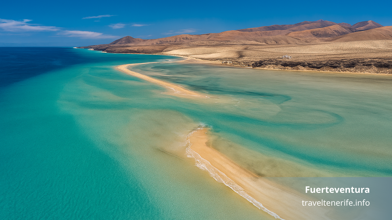
Within the seven main Canary Islands, Tenerife holds a central role — geographically, economically, and logistically. It sits almost in the middle of the archipelago, making it a strategic hub for inter-island connections, both by sea and air. From a mapping perspective, Tenerife frequently appears as the focal point in regional diagrams, with ferry and flight routes radiating out to other islands like Gran Canaria, La Palma, La Gomera, and Fuerteventura.
When using a map of Tenerife in Spain, or a general Canary Islands transport map, you’ll notice a few key features:
- Ferry routes: Operated by Fred Olsen and Naviera Armas, ferries connect Tenerife to Gran Canaria, La Gomera, El Hierro, and La Palma. Most routes originate from Santa Cruz de Tenerife or Los Cristianos.
- Air travel: Tenerife has two airports — Tenerife North (TFN) and Tenerife South (TFS) — offering inter-island flights operated by Binter Canarias and Canaryfly, often with journey times under 40 minutes.
- Strategic positioning: Tenerife is equidistant to several of the smaller islands, making it a frequent “stopover” for travelers combining two or three islands in one trip.
Many downloadable PDFs and tourism brochures include overview maps of the entire archipelago, often with infographics showing:
- Distances between islands (in km or travel time)
- Ferry terminals and airport locations
- Suggested multi-island routes or packages
For example, a visitor might plan a week with stops in Tenerife, La Gomera, and El Hierro — all reachable within a few hours via coordinated ferry lines. In such cases, inter-island maps help travelers plan logical itineraries and visualize how Tenerife connects to the broader region.
From a cultural standpoint, Tenerife is often seen as the “mainland” of the Canaries — home to the parliament, major universities, and the busiest port. It’s also a reference point on historical maritime maps, where it served as a critical node in transatlantic navigation.
Today, interactive tools like Google Maps or Rome2Rio make it easier than ever to understand the relative location of Tenerife within the Canary Islands and Spain. But traditional PDF-based maps remain useful for orientation, especially when showing ferry networks or regional travel planning.
So whether you’re island-hopping or simply trying to understand Tenerife’s place on the broader map of Spain showing the Canary Islands, viewing it in full archipelago context provides deeper insight into its importance, accessibility, and versatility as a travel destination.
Map Resources by Interest: Resorts, Beaches, Attractions
Not all travelers explore Tenerife in the same way. Some come for the beaches, others for resort luxury, nature, or cultural landmarks. That’s why having access to thematic maps based on personal interests can make trip planning far more effective. Instead of navigating an all-purpose Tenerife Spain map, visitors benefit from specialized resources that highlight what matters most to them — whether that’s surf-friendly beaches, family resorts, or must-see attractions.
The official Tenerife tourism portal and various local councils provide interest-based maps in both digital and printable formats. These include:
Resort Zone Maps
These maps highlight the main hotel and resort areas in southern Tenerife, including:
- Costa Adeje
- Playa de las Américas
- Los Cristianos
They typically show the location of accommodations, shopping centers, dining districts, medical centers, and local taxi or bus stops. Many include walking-distance indicators and icons for accessibility features. These maps are often available at hotel receptions or online as downloadable brochures.
Beaches and Swimming Zones
Beach maps are divided by beach type (urban, natural, secluded) and services available (lifeguards, restrooms, parking, restaurants). Examples of popular beaches shown on these maps include:
- Playa del Duque (upscale, accessible)
- Playa Jardín (black sand, family-friendly)
- El Médano (windy, popular with surfers)
The Beaches of Tenerife PDF map, downloadable from official sources, categorizes and locates nearly every major coastal spot. Some maps also show tide zones and flag warnings.
Attractions and Cultural Points
These maps focus on places of interest such as:
- Historical centers (La Laguna, Garachico, La Orotava)
- Theme parks (Siam Park, Loro Parque)
- Religious sites (Candelaria Basilica)
- Museums, art galleries, botanical gardens
They often include QR codes linking to attraction hours or ticket info. Some municipalities, like San Cristóbal de La Laguna, publish their own detailed city maps with historical walking tours.
Scenic Routes and Viewpoints
Tenerife’s terrain is ideal for self-guided scenic drives or photo safaris. Specialized maps highlight:
- Viewpoints (miradores) with panoramic island or ocean views
- Volcano and crater loops through Teide National Park
- Wine route maps through the Tacoronte-Acentejo region
These maps help identify where to stop, what to see, and how to link attractions efficiently.
Activity-Specific Maps
There are also maps for:
- Cycling routes (road and mountain)
- Diving and snorkeling zones
- Birdwatching hotspots
- Accessible travel facilities
Each of these is often produced by tourism boards or special interest organizations. Some are standalone PDFs, while others appear in printed guidebooks.
By combining general-purpose navigation tools with interest-based maps, travelers get more tailored experiences. A standard map of Tenerife Spain may help with orientation, but thematic maps allow you to dive deeper into what matters most to you — whether that’s hiking, history, or hammocks.
Frequently Asked Questions About Tenerife Maps
When planning a trip to Tenerife, many visitors have practical questions about which maps to use, where to find them, and how to navigate the island efficiently. Below are the most frequently asked questions related to maps, navigation tools, and travel planning across the island.
Q1: Where can I download a reliable map of Tenerife?
A: The official tourism website (webtenerife.com) offers downloadable PDF maps covering road networks, beaches, hiking trails, public transport, and city plans. Most are available in English and formatted for A4 printing.
Q2: Does Google Maps work well in Tenerife?
A: Yes, Google Maps covers Tenerife in detail, including smaller towns, ferry terminals, and most hiking trails. You can also download an offline version of the island map, which is especially useful in mountainous areas with limited signal.
Q3: Are there specialized maps for hiking and nature routes?
A: Absolutely. There are dedicated PDF maps for Teide National Park, Anaga Rural Park, and Masca, as well as trail-specific GPX downloads on apps like AllTrails and Komoot. The official “Senderos” map from Turismo de Tenerife is one of the most complete printed hiking references.
Q4: Can I get a printed map at the airport or tourist centers?
A: Yes. Tourist offices at Tenerife South Airport (TFS), Tenerife North Airport (TFN), and major towns distribute free printed maps, including resort zones, city centers, and public transport guides.
Q5: Which maps are best for driving around Tenerife?
A: The Official Road Map of Tenerife (PDF) is detailed and useful for planning routes, especially in rural or mountainous areas. Offline navigation apps like Sygic or MAPS.ME are also recommended for drivers who want GPS directions without mobile data.
Q6: Are there maps showing ferry routes between islands?
A: Yes. Inter-island ferry routes are shown in regional maps of the Canary Islands. These are available in printed tourist guides and online from ferry operators like Fred Olsen and Naviera Armas. Some PDFs also show travel durations and port facilities.
Q7: What is the best way to access Tenerife map content offline?
A: Download PDF maps from official sources and save them in apps like Adobe Reader or Google Drive. For real-time guidance, use offline map apps (e.g., Google Maps with offline mode or MAPS.ME). Screenshots also work for quick reference.
Q8: Are there themed maps (e.g., for beaches, wine routes, or cycling)?
A: Yes. Tenerife tourism authorities provide specific maps for interests such as surfing, cycling, wine tasting, and family-friendly beaches. These can usually be downloaded or picked up at local tourist offices.
Q9: Is there a map that shows Tenerife’s position relative to the rest of Spain?
A: Yes. Maps that show Tenerife in Spain or Tenerife on the map of Spain are often included in general travel guides, infographics, and ferry route maps. They help travelers understand the island’s Atlantic position, far from mainland Spain.
Q10: Do all maps use English place names?
A: Most tourist maps include bilingual labels (Spanish and English), especially in resort areas. However, local apps and older maps may use Spanish only, so it’s useful to familiarize yourself with key terms and place-name variants.
Conclusion
Whether you’re looking for vintage prints or digital tools, maps Tenerife Spain are essential for every kind of traveler. The wide variety of available resources reflects the island’s diversity: its cities, beaches, nature parks, and cultural sites all benefit from their own mapping solutions.
Throughout this guide, we’ve covered everything from Google Maps for Tenerife, to downloadable PDF brochures, to historical reproductions of 18th-century cartography. If you’re planning a beach vacation, a hiking adventure, or an island-hopping itinerary, having access to detailed, up-to-date maps will significantly enhance your experience.
For those traveling with mobile access, apps like MAPS.ME, Komoot, and Google Maps allow you to move around the island with confidence — even when you’re off the beaten path. For those who prefer something tangible, printable and foldable maps are widely available and still trusted by seasoned travelers, especially in remote or low-signal areas.
Tenerife’s role within the broader context of the Canary Islands also makes navigation more dynamic. Whether you’re taking a ferry to La Gomera, flying to Gran Canaria, or planning a road trip from Los Cristianos to El Teide, reliable mapping tools are essential.
Having a detailed Tenerife in Spain map ensures clarity when planning multi-island trips or understanding how Tenerife fits into the wider Spanish geography.
Don’t overlook the usefulness of themed or specialized maps: a beaches map can help you find the perfect coastal spot, while a wine route map might lead you through the scenic valleys of northern Tenerife. Likewise, resort area maps simplify city walks and cultural discovery.
Ultimately, a well-selected set of navigation resources helps you make the most of your time, avoid confusion, and uncover corners of the island you might otherwise miss. From vintage parchment to modern GPS — every map adds dimension to your journey.
So before you land, download a Tenerife Spain map, print the trails that interest you, or save a screenshot of your resort zone. With the right guidance in hand — digital or paper — you’re ready to explore one of the most fascinating and varied islands in Spain with clarity and confidence.
